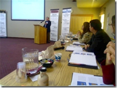
Ed talked about the current digitization program being used in the LC map reading room. He then looked at some of the research that can now be done because of the items currently digitized.
Something interesting — these are research quality scans — which the idea being that once digitized, these items will never be pulled for reference again. Another interesting thing — Ed had mentioned that LC, since starting map digitization, had digitized some 10,000 maps in the past 10 or so years. However, they acquire close to 70,000 maps a year. I’m not a math wiz, but looking at those numbers simply shows how much content simply isn’t be digitized.
Also, Ed talked about maps that are actually created by the LC maps room. This was something I was aware of. When I visited the LC about two years ago, one of the things that I had an opportunity to see was the GIS lab in the Map room where LC creates custom maps for Congress on a number of topics. At the time, I was told that LC couldn’t make those generated maps available because of the sensitivity of the requests. However, Ed seemed to indicate that LC is looking at ways to overcome some of the privacy issues currently keeping these maps from circulation. And they are at this point out of circulation. He’d noted afterwards, that even though LC creates the maps and keeps a digital copy of the GIS project — the library itself, doesn’t archive a copy of the generated map. In only exists within the archives of the laboratory. Interesting…
Ed also showed off a number of interesting maps from the reading room. He was kind enough to give me a copy of his presentation. See below.
- Slides (ppt)
–TR
